UAV Estimation of Rice Chlorophyll
UAV-Based Estimation of Rice Chlorophyll Content Using Machine Learning
Photograph a rice paddy from a drone, then let machine learning read crop health out of the imagery — no field sampling required.
- Role
- Research Assistant
- Period
- Jan. 2024 – Jan. 2026
- Institution
- Key Laboratory of Quantitative Remote Sensing, Ministry of Agriculture and Rural Affairs; Information Technology Research Center, Beijing Academy of Agriculture and Forestry Sciences
Why this matters
Judging how well rice is growing traditionally means walking the field, taking samples, and assaying chlorophyll in a lab — slow, laborious, and limited to a handful of points. Drone imagery can cover a whole field at once. The hard part is that imagery yields hundreds of candidate features, and only a few of them actually carry signal.
What I did
- Processed multi-temporal remote sensing imagery data from drones.
- Employed machine learning methods such as SHapley Additive exPlanations (SHAP) and Particle Swarm Optimization (PSO) for feature selection.
- Assisted in optimizing ensemble learning models, leveraging the PSO algorithm to enhance the models' predictive capabilities and multi-stage generalization performance.
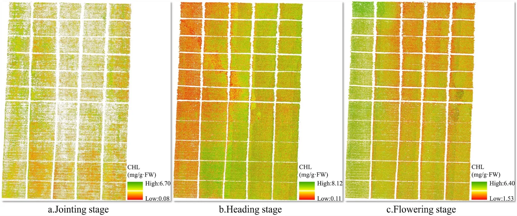
- Identified key features correlated with the chlorophyll content of rice paddies.
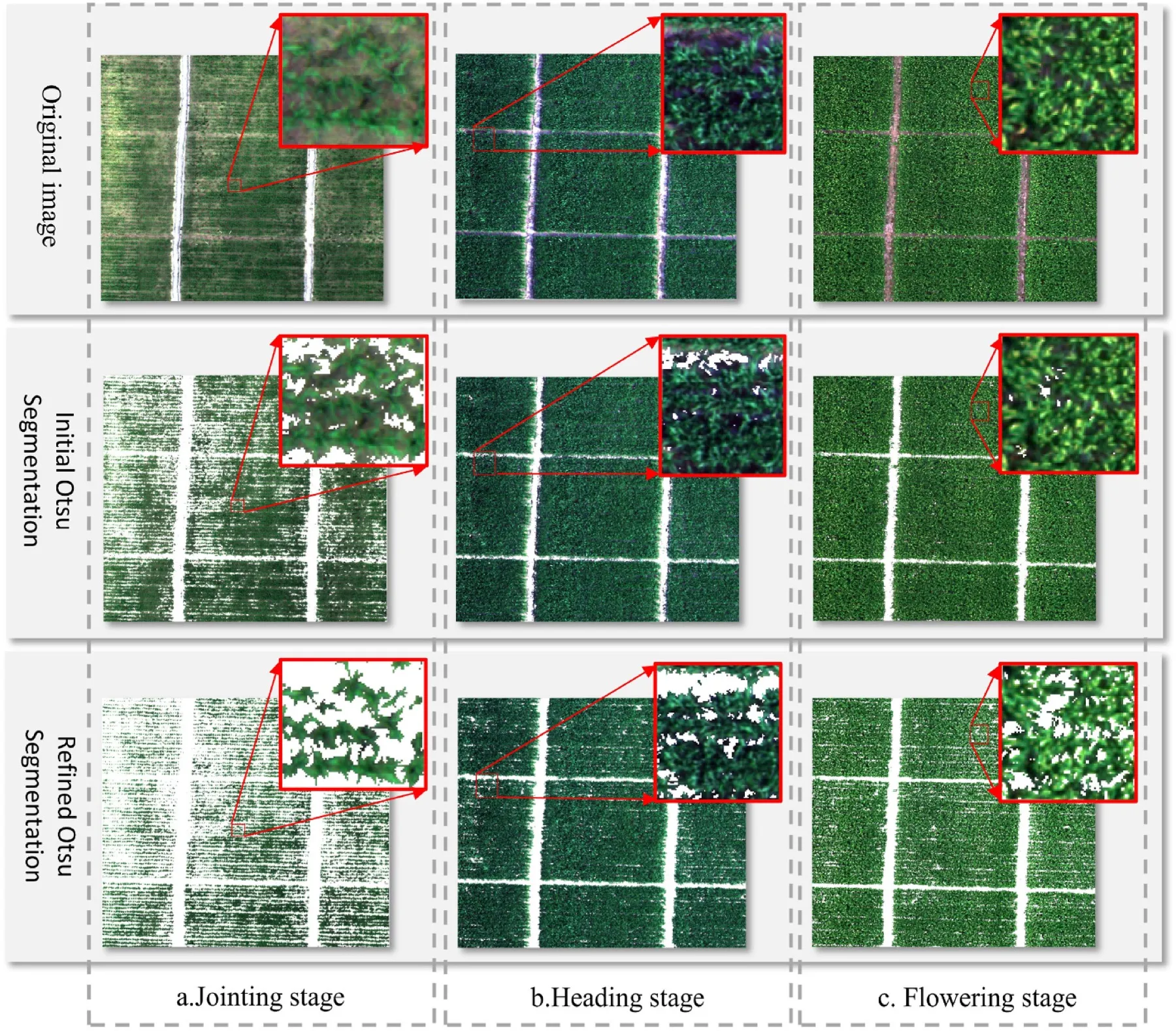
Both figures below are from the following paper, on which I am the fourth author.
Wang, T., Yang, G., Xu, X., Sun, J., Meng, Y., Yang, X., Feng, H., Xue, H., Xu, X., & Song, Y. (2026). Remote sensing estimation of rice chlorophyll content based on UAV image feature selection and PSO-optimized ensemble learning. Artificial Intelligence in Geosciences, 7, 100190. https://doi.org/10.1016/j.aiig.2026.100190
Open access under CC BY-NC-ND 4.0. Figures reproduced unmodified.
Outcome
- Co-authored paper published in Artificial Intelligence in Geosciences (2026).
- Second co-authored paper on rice leaf area index estimation submitted for publication (2025).
Technologies
- Python
- Machine Learning
- SHAP
- Particle Swarm Optimization
- Ensemble Learning
- Remote Sensing